The Dorset landscape is littered with the signs of ancient settlements, Bronze age tombs to Iron Age hill forts, Roman roads and villas, abandoned medieval villages and large country mansions and estates. Cranbourne chase has the lot, and now the remains of a wartime airfield sit amongst ancient remains in this most rural of English counties.
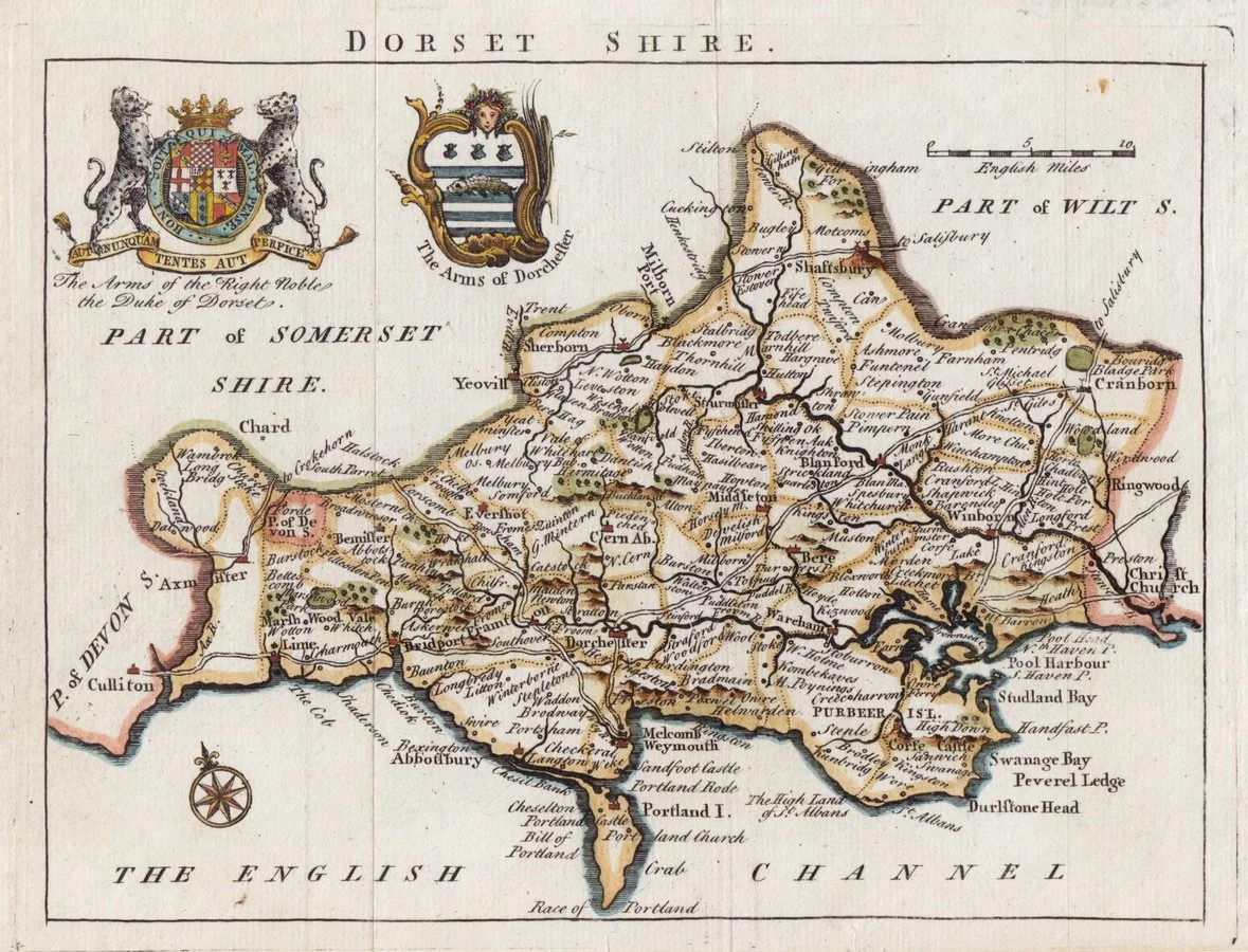
This map from 1748 was drawn by Robert Walker.
Several entries in William the Conquerors survey of England record who owned the Tarrant Valley, with Preston farm mentioned by name. The large estates of Crichel and Kingston Lacy grew from the 15th century, but by the 20th century these had started to fragment into smaller farms.
-

Domesday book entries
Folio 77v of Domesday covers the Tarrant Valley in Dorset, the section above can be translated as
DORSET
VI. THE LAND OF THE BISHOP OF LISIEUX
THE BISHOP OF LISIEUX holds TARRANT CRAWFORD. Wulfweard held it TRE, and it paid geld for 5 hides. There is land for 3 ploughs. Of this 3 hides and 1 virgate of land are in demesne, and there are 2 ploughs, and 4 slaves; and 2 villans and 13 bordars with 1 plough. There is a mill rendering 5s , and 9 acres of meadow, pasture 5 furlongs long and 1 furlong wide, [and] woodland 2 furlongs long and 2 wide. It was worth 4l ; now 100s.
The same bishop holds PRESTON [in Tarrant Rushton]. Edward the clerk held it TRE, and it paid geld for 1 hide. There is land for 1 plough. There is half and acre of meadow, and pasture 4 furlongs long and as much wide. It was and is worth 20s.
The same bishop holds TARRANT KEYNESTON. Herling held it TRE, and it paid geld for 10 hides and the third part of half a hide. There is land for 8 ploughs. Of this 5 1⁄2 hides are in demesne, and there are 3 ploughs, and 6 slaves; and 12 villans and 14 bordars with 4 ploughs. There are 2 mills rendering 30s and 1,000 eels, and 76 acres of meadow, and pasture 22 furlongs in length and width, [and] woodland 8 furlongs long and as many wide. It was and is worth 13l.
-

19th century estates
Almost 800 years after Domesday and the land just east of the future airfield is parcelled into field boundaries recognisable today. This parish tithe map from 1849 shows the Hemsworth farm when it, like Crook farm, was part of the large Crichel estate centred on Crichel house. Home to the Sturt family from the 16th century, family connections remain today.
A large area to the west of Hemsworth was open downland, in the middle of which sat Crook farm.
John Harding bought Crook farm with 548 acres from Humphrey Sturt and the Crichel estate in 1919, it would pass downnthrough the family until sold in 2023 at which point it had grown to over 1400 acres and acqu red several of the cottage in the village of Tarrant Rushton.
-

On the eve of a wartime role.
The little village of Tarrant Rushton sits alongside the Tarrant stream with a church and school and what at the time was thought to be the site of a small hospital for leprosy in the 14th century.
The road up from the village crosses the open downland of Abbeycroft and passes Crook farm before reaching the junction with the road to Witchampton, today the site of Windy Corner nd the airfield memorial stone.
This map shows the relatively flat nature of the elevated plateau that attracted the Air Force planers in 1942 when they were searching for a site that would become one of many airfields being prepared to enable a successful invasion and liberation of a Europe plunged into war at the end of the troubled 1930s.